UMap: Difference between revisions
No edit summary |
No edit summary |
||
| (7 intermediate revisions by the same user not shown) | |||
| Line 1: | Line 1: | ||
= uMap ? = | = uMap ? = | ||
uMap is an online free software to create maps, an instance is installed here https://map.calafou.org/ (you can choose the language) | uMap is an online free software to create maps, an instance is installed here https://map.calafou.org/ - ! Solo es accessible desde el red local de calafou ! - (you can choose the language in catala : https://map.calafou.org/ca/) | ||
= Utilisation = | = Utilisation = | ||
See the documentation here : https://wiki.openstreetmap.org/wiki/UMap#Tutorials and a [https://wiki.openstreetmap.org/wiki/UMap/Guide Guide] | See the documentation here : https://wiki.openstreetmap.org/wiki/UMap#Tutorials and a [https://wiki.openstreetmap.org/wiki/UMap/Guide Guide] | ||
[[File:Umapcalafou.png]] | [[File:Umapcalafou.png|800px]] | ||
= Edition = | |||
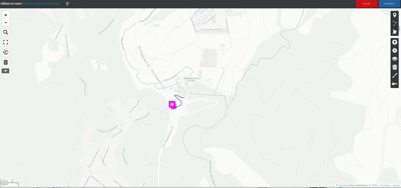
To edit an existing map, you can login with the generic user here : https://map.calafou.org/fr/login/ | |||
user : umap | |||
password : calafou | |||
To change the format of fields like Description : | |||
<code> | |||
*simple astérisque pour italique* | |||
**double astérisque pour gras** | |||
# un dièse pour titre 1 | |||
## deux dièses pour titre 2 | |||
### trois dièses pour titre 3 | |||
Lien simple : [[https://exemple.fr]] | |||
Lien avec texte : [[http://exemple.fr|texte du lien]] | |||
Image : {{http://image.url.com}} | |||
Image avec largeur (en pixels) : {{http://image.url.com|largeur}} | |||
Iframe : {{{http://iframe.url.com}}} | |||
Iframe avec hauteur (en pixels): {{{http://iframe.url.com|hauteur}}} | |||
Iframe avec hauteur et largeur (en px) : {{{http://iframe.url.com|height*width}}} | |||
--- pour un séparateur horizontal | |||
</code> | |||
= Add a form for each new point of a layer = | |||
To add fields to be filled for each new point of a layer : | |||
# Add a new layer | |||
# Edit the layer with the table view | |||
## Add as many properties as needed, the name and the description are default fields, no need to add them (for example : Color) | |||
## Keep the name of each field | |||
## Save these properties | |||
# Edit with the pen icon the properties of the layer : Interactive options : | |||
## Choose "big Pop-up" as the pop-up form | |||
## Choose "table" as a gabarit | |||
## In "Gabarit du contenu de la popup" add each property / field inside brackets : (for example : {Color}) | |||
# Save and try to add a new point in this layer to see if all the fields are presents | |||
= Installation = | = Installation = | ||
| Line 16: | Line 51: | ||
The configuration file is here : | The configuration file is here : | ||
nano /etc/umap/umap.conf | nano /etc/umap/umap.conf | ||
== Add icons == | |||
* See https://umap-project.readthedocs.io/en/latest/administration/#icons | |||
== Add Map tile layers == | |||
* See https://framacloud.org/fr/cultiver-son-jardin/umap.html | |||
== If the database is corrupted (oops, serveur pb) == | |||
Restore the database https://www.postgresql.r2schools.com/postgresql-panic-could-not-locate-a-valid-checkpoint-record/ | |||
Latest revision as of 22:40, 6 January 2023
uMap ?
uMap is an online free software to create maps, an instance is installed here https://map.calafou.org/ - ! Solo es accessible desde el red local de calafou ! - (you can choose the language in catala : https://map.calafou.org/ca/)
Utilisation
See the documentation here : https://wiki.openstreetmap.org/wiki/UMap#Tutorials and a Guide
Edition
To edit an existing map, you can login with the generic user here : https://map.calafou.org/fr/login/ user : umap password : calafou
To change the format of fields like Description :
   *simple astérisque pour italique*
   **double astérisque pour gras**
   # un dièse pour titre 1
   ## deux dièses pour titre 2
   ### trois dièses pour titre 3
   Lien simple : [[1]]
   Lien avec texte : [du lien]
   Image : Template:Http://image.url.com
   Image avec largeur (en pixels) : Template:Http://image.url.com
   Iframe : {{{http://iframe.url.com}}}
   Iframe avec hauteur (en pixels): hauteur
   Iframe avec hauteur et largeur (en px) : height*width
   --- pour un séparateur horizontal
Add a form for each new point of a layer
To add fields to be filled for each new point of a layer :
- Add a new layer
- Edit the layer with the table view
- Add as many properties as needed, the name and the description are default fields, no need to add them (for example : Color)
- Keep the name of each field
- Save these properties
- Edit with the pen icon the properties of the layer : Interactive options :
- Choose "big Pop-up" as the pop-up form
- Choose "table" as a gabarit
- In "Gabarit du contenu de la popup" add each property / field inside brackets : (for example : {Color})
- Save and try to add a new point in this layer to see if all the fields are presents
Installation
uMap installed in a lxc ubuntu bionic container
Following the installation process of this documentaion worked, with a few modifications :
sudo apt install build-essential autoconf python3.6 python3.6-dev python-virtualenv wget nginx uwsgi uwsgi-plugin-python3 postgresql-10 postgresql-server-dev-10 postgresql-10-postgis-2.2 git libxml2-dev libxslt1-dev zlib1g-dev
sudo apt install postgresql-10-postgis-2.4 postgresql-10-postgis-2.4-scripts postgresql-10-postgis-scripts
The configuration file is here :
nano /etc/umap/umap.conf
Add icons
Add Map tile layers
If the database is corrupted (oops, serveur pb)
Restore the database https://www.postgresql.r2schools.com/postgresql-panic-could-not-locate-a-valid-checkpoint-record/
